
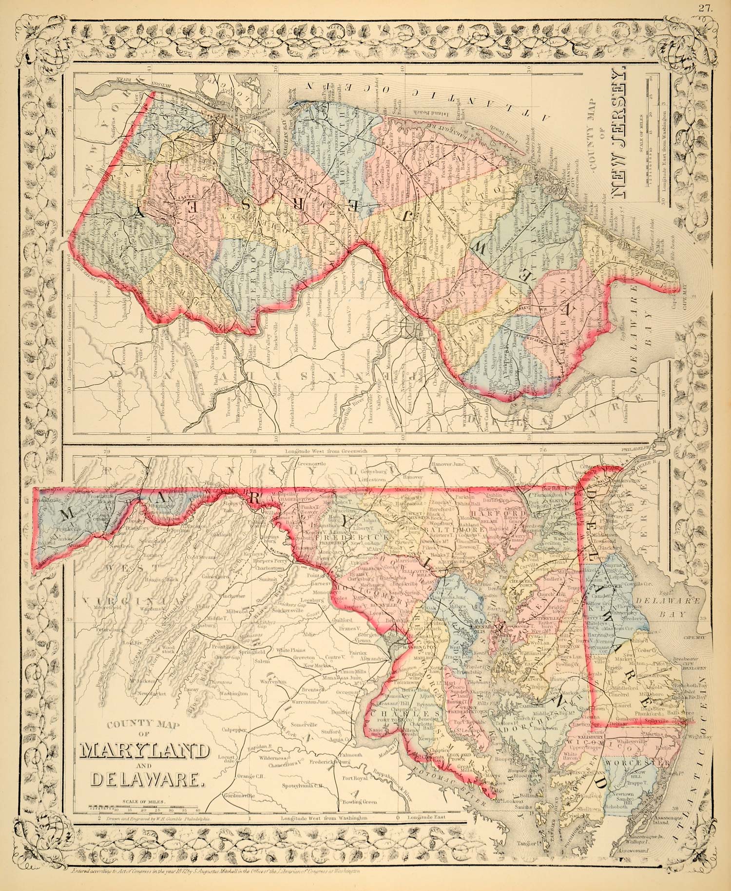
1872 Map Maryland Delaware New Jersey State Counties - ORIGINAL MGA1
This is an original 1872 hand-colored engraved map of the states of Maryland, Delaware, and New Jersey including counties. Drawn and engraved by W. H. Gamble, Philadelphia.
Period Paper is pleased to offer a rare collection of original antique maps of the countries of the world including various city plans. These hand-painted original engravings are extremely well-detailed and are illustrated with a decorative border making them especially suitable for framing. In spectacular condition, this collection will be of interest to the historian and map aficionado, as well as to the general collector and/or interior designer.
This map is an original General Mitchell's Atlas Hand-Colored Map and is NOT a reprint, modern-day reproduction, or digital copy. The map offered here is authentic to 1872. 'Entered according to Act of Congress in the year 1872 by A. Augustus Mitchell in the Office of the Librarian of Congress at Washington' as marked at the bottom of each map.
CONDITION
This 139+ year old Item is rated Near Mint / Very Fine+. Light aging in margins. No creases. No natural defects. No surface rub. No tears. No water damage.
- Product Type: Original Print Map; Hand-Tinted Color
- Grade: Near Mint / Very Fine+
- Dimensions: Approximately 12.25 x 15 inches; 31 x 38 cm
- Authentication: Serial-Numbered Certificate of Authenticity w/ Full Provenance
- Protection: Packaged in a custom archival sleeve with an acid-free black board (great for display, gift-giving, and preservation)
Keywords specific to this image: Delaware River, Delaware Bay, Atlantic Ocean, Potomac River, Chesapeake Bay, Hudson River
MGA1C72