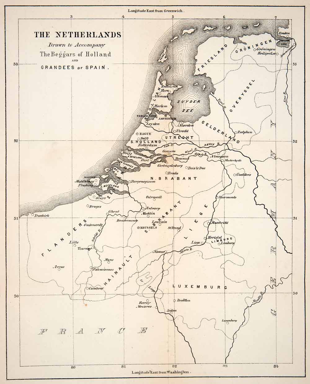
This is an original 1867 black and white relief line-block map of the Netherlands, drawn to accompany the Beggars of Holland, and the Grandees of Spain. The map includes places such as Hainault, Gederland, Overyssel, Friesland, and Gröningen.
CONDITION
This 144+ year old Item is rated Very Fine ++. No creases. Original portfolio crease. No surface rub. No tears. Light water staining.
-
Product Type: Relief Line-block Map; Black / White
-
Grade: Very Fine ++
-
Dimensions: Approximately 6.5 x 8 inches; 17 x 20 cm
-
Authentication: Serial-Numbered Certificate of Authenticity w/ Full Provenance
-
Protection: Packaged in a custom archival sleeve with an acid-free black board (great for display, gift-giving, and preservation)
Keywords specific to this image: Utrecht, Zuyder Zee, N. Holland, S. Holland, Gorcum, Breda, Valenciennes, Cambray, Zutphen, Bergenopzoom, Hague
XER3C67